
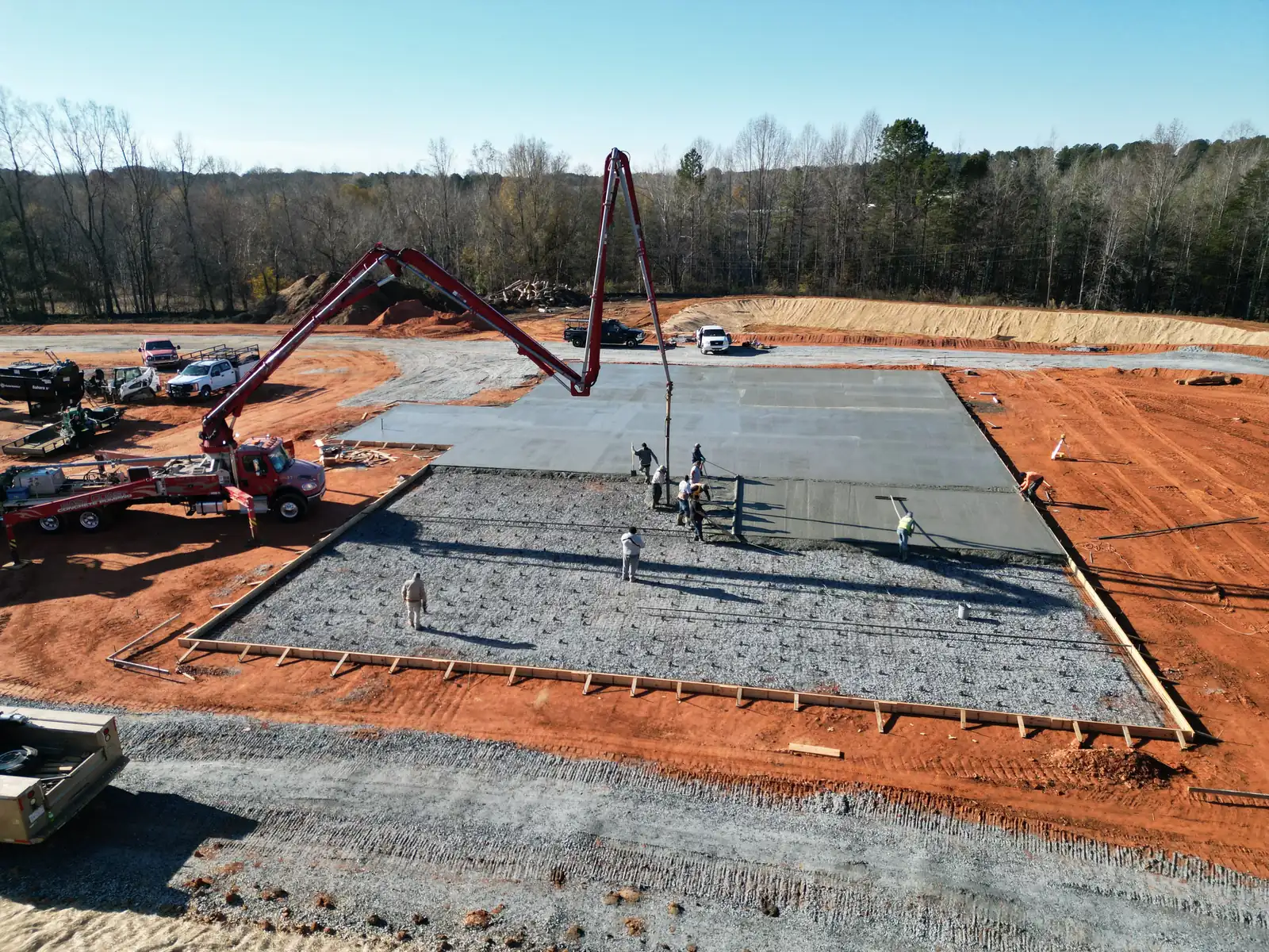
Clear documentation built for communication.
Deliverables can be tailored to the project, but the goal stays the same: make current conditions and visible progress easy to review and share.
Dated aerial imagery
High-resolution images from every visit, dated so the record stands on its own.
Repeatable viewpoints
Consistent viewpoints and timing make progress easier to compare, where practicable.
Progress comparisons
Side-by-side imagery highlights visible change between scheduled visits.
Milestone documentation
Dated visual evidence of important project phases.
Stakeholder reports
Concise visual reports that give owners, contractors and managers a shared view.
Historical project record
Organized over successive visits, from baseline to completion.
Scope note. GroundTrace provides aerial visual documentation and observations. It does not replace licensed surveying, engineering, architectural review, code inspection, safety inspection or other regulated professional services.
What is inside your GroundTrace report.
Real pages from a sample GroundTrace report: the same layout you would receive, with illustrative data.
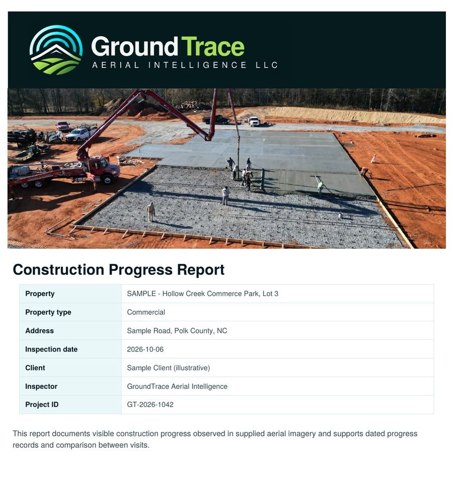
1A clear first page
Project, site, date and who it was prepared for, with a plain-English summary of what the visit found.
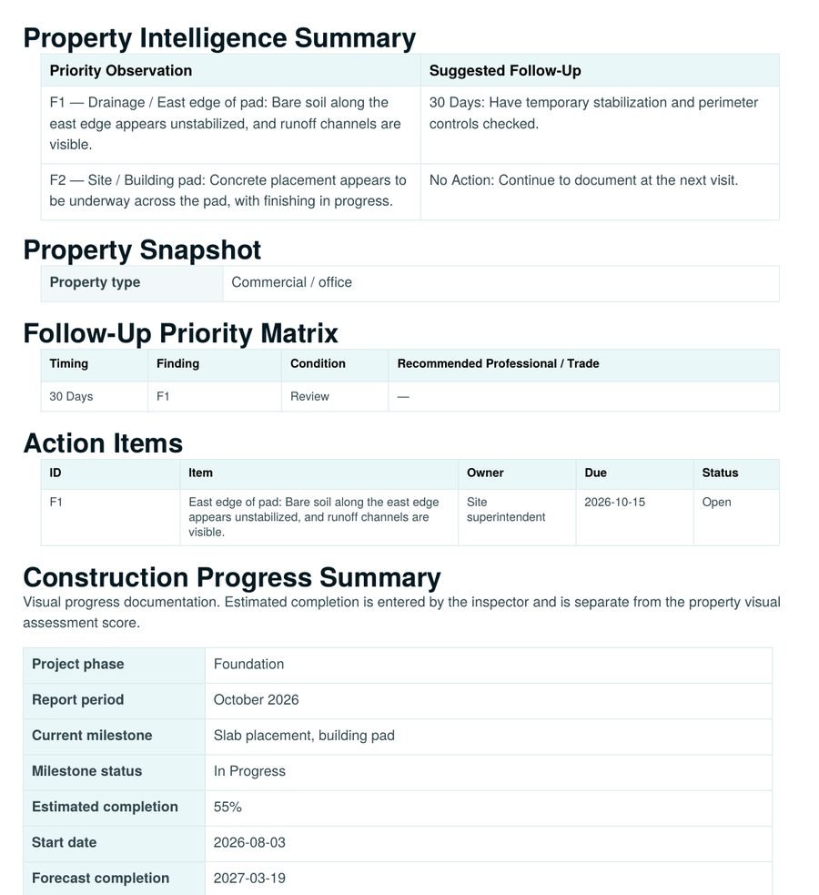
2Follow-up you can act on
A priority matrix and action items with an owner, due date and status for each item, plus a progress summary entered by the inspector.
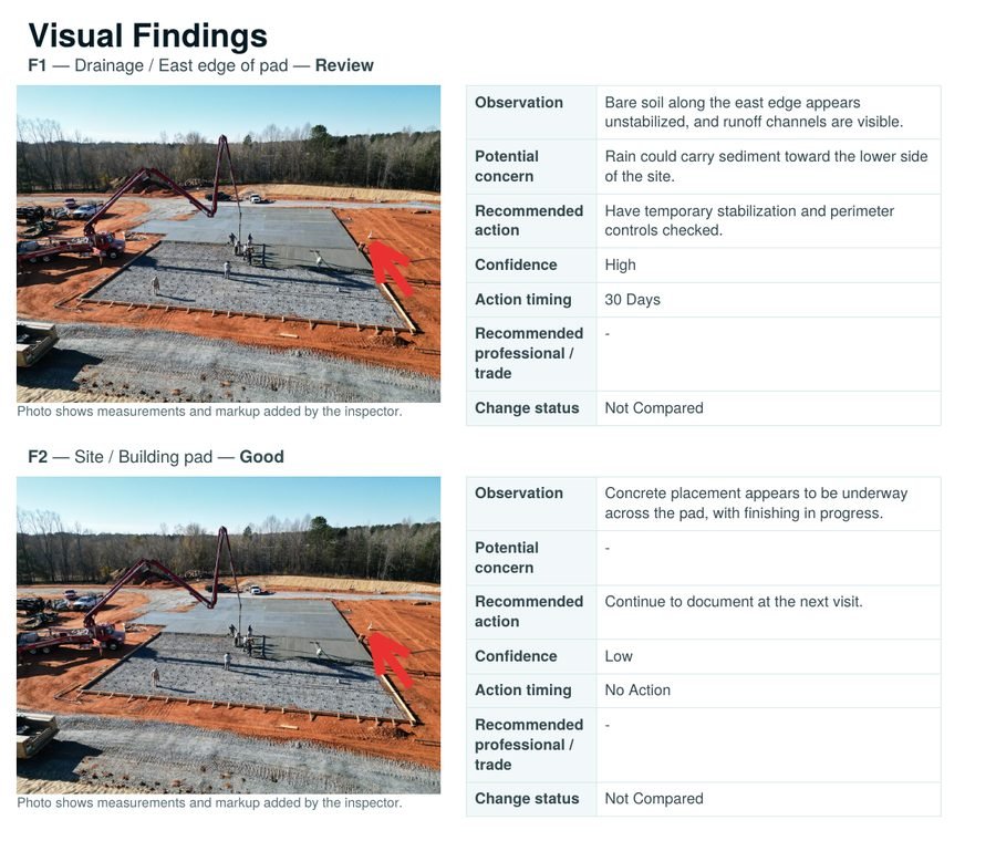
3Findings with marked-up photos
Each finding shows the photo, what is visible, why it might matter, a suggested action and a suggested timing.
Sample report. The photo and details shown are illustrative. Your report uses your own project photos, reviewed by a person before it reaches you.
Built by someone who knows the job site.
GroundTrace comes from decades of work in construction, including civil sitework. That is why the reports follow the way a job is actually run: by phase, zone and milestone. Photos are taken to show progress, findings are worded plainly, and nothing goes out that a person has not reviewed.
- ExperienceDecades in construction and civil sitework
- CertifiedFAA Part 107 remote pilot
- Organized byPhase, zone and milestone
- ReportsReviewed by a person before delivery
Match the schedule to the project.
Not every project needs the same frequency. GroundTrace can structure documentation around recurring intervals or important milestones.
One-time
Document a specific stage, milestone or current site condition.
Monthly
A practical recurring record for many longer-duration projects.
Twice monthly
More frequent visual updates when visible progress changes quickly.
Milestone-based
Documentation scheduled around defined project stages rather than calendar dates.
Simple packages. Clear starting prices.
Clear starting prices for typical sites. We confirm the scope with you before you commit.
One-Time Snapshot
$950one time
One documentation flight with a short progress summary.
Delivered in 2 business days
Monthly Monitoring
$895per month
One visit a month with repeatable viewpoints and a stakeholder-ready progress report.
Delivered in 2 business days
Biweekly Monitoring
$1,650per month
Two visits a month for faster-moving projects.
Each report in 2 business days
Weekly Monitoring
from$2,950per month
Up to four visits a month for high-activity projects.
Each report in 1 to 2 business days
Milestone Package, $2,695. Three pre-planned visits at the stages that matter, such as foundation, structure and completion. A bridge between a one-time snapshot and monthly monitoring.
Add-ons. Edited progress video, extra acreage or buildings, approximate measurement annotations and rush scheduling are priced separately. Ask when you request a quote.
What changes the price. Site size, number of visits, the deliverables you need and distance from our service base.
Travel. Travel within about 25 miles is included. Longer trips add a modest, quoted travel fee. Weather and airspace reschedules are never charged.
A consistent process for a changing jobsite.
Each visit is made comparable to the last, turning individual flights into an organized visual history of the project.
-
Establish the view
Document initial site conditions and identify useful, repeatable aerial perspectives.
-
Return consistently
Schedule repeat flights or milestone visits from similar viewpoints whenever conditions allow.
-
See what changed
Review visible progress, site development and major changes between documented visits.
-
Share the record
Organize imagery and observations into concise updates for project stakeholders.
From site preparation to completion
The greatest value comes from consistency. Each scheduled visit adds another reference point to a visual timeline of the jobsite.
-
Site preparation
Document access, grading, cleared areas and initial site development.
-
Foundation and structure
Capture progress through foundation, framing and structural stages.
-
Exterior and site work
Track exterior work, site improvements and visible changes across the project.
-
Completion
Document the completed project and preserve the progression from baseline to finish.
One visual record. Multiple stakeholders.
Construction monitoring is most valuable when everyone looks at the same current, dated visual information instead of relying on memory, scattered photos or unnecessary site visits.
- General contractorsDocument visible progress and improve project communication.
- DevelopersMaintain visibility across active sites and important milestones.
- Property ownersSee how work is progressing without being onsite for every update.
- Project managersGive teams a consistent visual reference for status discussions.
- Lenders and investorsSupport progress conversations with dated visual documentation where appropriate.
Ready to build the record?
Tell us about the project, timeline and the stakeholders who need updates. We will discuss an appropriate aerial documentation schedule.
Prefer to talk first? Call (864) 680-1764 or email info@groundtraceaerial.com. Serving Western North Carolina and Upstate South Carolina.
Flown by an FAA Part 107 certified remote pilot and scheduled with your site contact.